Our Services
Full-spectrum scanning capability
From heritage buildings to highway corridors, we have the equipment and expertise to capture it in 3D.
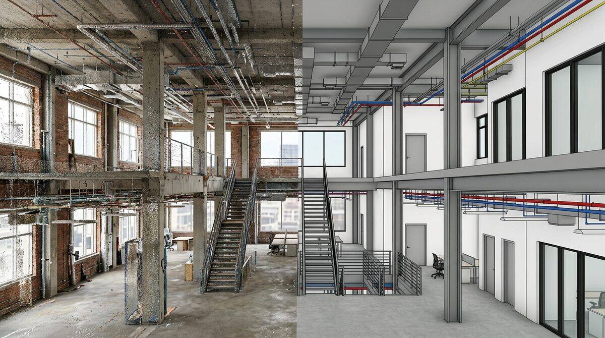
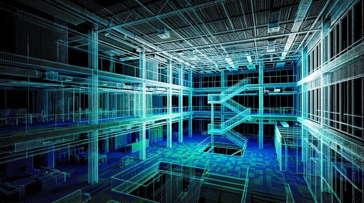
Architectural & BIM Scanning
High-density laser scanning for architecture, renovation, and BIM modelling projects. We capture existing conditions to sub-millimetre accuracy so your design team can work from reality, not guesswork.
Civil & Infrastructure
LiDAR surveys for roads, bridges, rail corridors, and civil earthworks. From design verification to as-built documentation, we capture infrastructure at any scale.
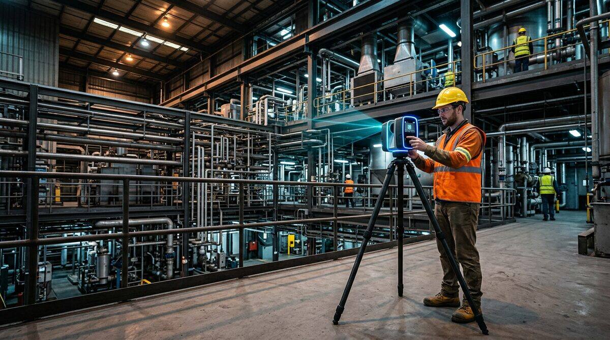
Industrial & As-Built
Comprehensive as-built documentation for factories, processing plants, warehouses, and mechanical installations. Capture every pipe, duct, and structural member in 3D.
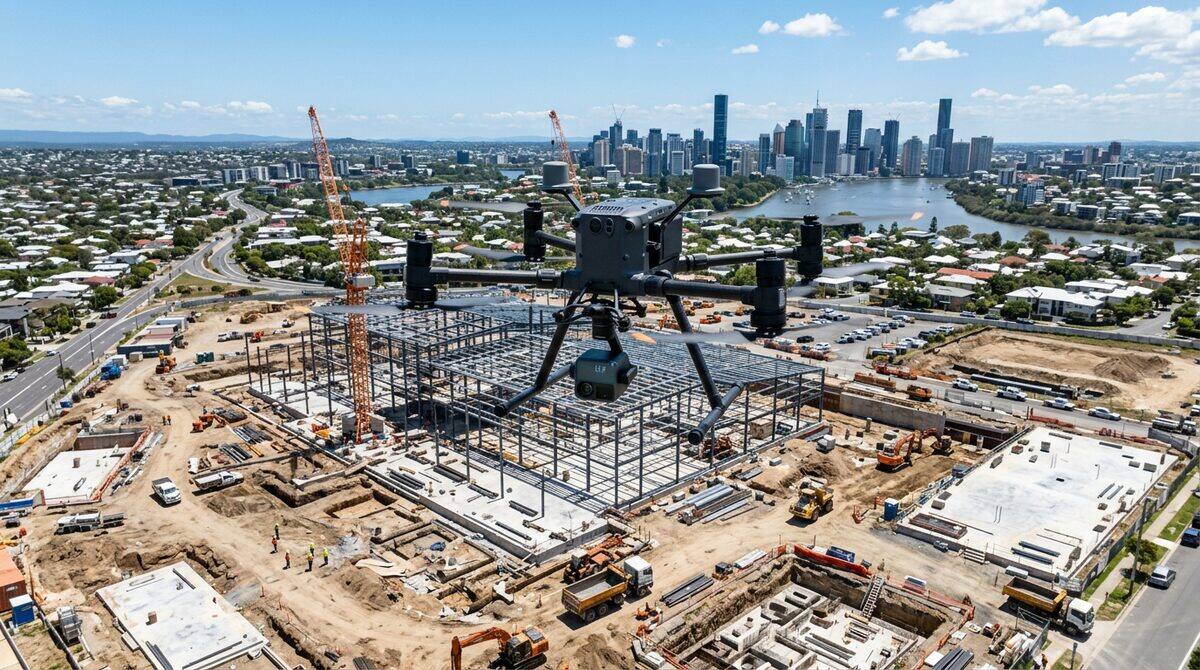
Aerial & UAV Mapping
Drone-based LiDAR and photogrammetry for sites that are too large, too remote, or too dangerous for ground-based methods. Topographic surveys, stockpile volumes, and ortho-imagery.
Not sure which service you need?
Tell us about your project and we will recommend the right approach, equipment, and deliverables.
Get in Touch